Construction documentation

A consistent aerial record of your project, visit after visit

Progress photos are most useful when every set can be compared with the last. SiouxSky captures your site from the same agreed positions and headings on each visit, then delivers dated, consistently named image sets your team can drop straight into reports, owner updates and project files.

The challenge

Why clients ask for construction progress

  • Owners and lenders want to see progress

    Stakeholders who can't visit the site still expect a clear picture of what has changed since the last update.

  • Ground photos don't show the whole site

    Staging, earthwork, utilities and building footprint are hard to understand from eye level.

  • Inconsistent angles make comparison impossible

    When each set is shot from wherever someone happened to stand, month-over-month comparison turns into guesswork.

What can be performed

Available services

  • Fixed viewpoint plan

    A set of capture positions, altitudes and headings agreed at the first visit and repeated every time after.

  • Milestone captures

    Single visits timed to key stages — site prep, foundations, framing, enclosure, site work, completion.

  • Recurring site visits

    Weekly, biweekly or monthly visits on a schedule matched to the pace of the project.

  • Progress clips

    Optional short aerial video passes over the site for presentations and owner updates.

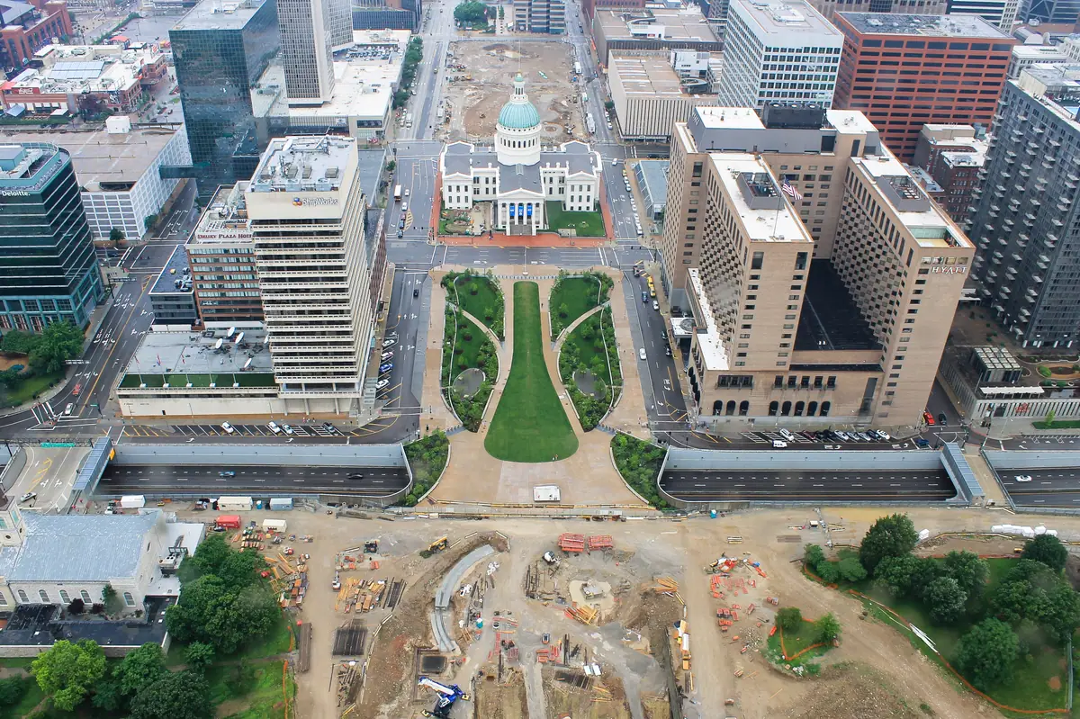
Overhead aerial view of an active construction site with excavation, staging areas and equipment beside downtown buildings
Sample imagery illustrating this type of work — not a SiouxSky client project. Photo: Christy Ash izelle (CC0). Credits

Scope & limitations

What this service is — and isn't

  • Progress imagery is a visual record. It does not measure quantities, verify grades or confirm work against plans or specifications.
  • Mapping, orthomosaics, volumetric calculations and 3D models are not currently offered.
  • Flights near active cranes, over workers or in controlled airspace require additional planning and may change the capture plan.
  • Weather can move a scheduled visit; recurring schedules include an agreed reschedule window.

How it works

How it works: Construction Progress

  1. 01

    Submit project details

    Tell us the location, what you need captured, your timeframe and how the results will be used.

    Share the site address, project timeline, site contact and who receives the updates.

  2. 02

    Receive a scope and quote

    You get a written scope listing views, deliverables, schedule assumptions and price — before anything is booked.

    The scope lists viewpoints, visit frequency, deliverables and per-visit or milestone pricing.

  3. 03

    Confirm schedule and flight feasibility

    Airspace, permissions, site access, weather and on-site conditions are reviewed and a flight window is set.

    Site orientation, crane activity, airspace and the visit calendar are confirmed before the first flight.

  4. 04

    Receive the agreed deliverables

    Edited, organized files are delivered to the structure agreed in your scope.

    Each visit is delivered as a dated set in the same structure, so records stay comparable.

Every flight depends on airspace, property-owner and site permissions, weather, site conditions and the regulations that apply at the time. If a flight can't be completed safely and legally, it won't be attempted — and you'll know before the visit.

Packages

How this work is typically scoped

Packages are starting points, not fixed menus. Each project is quoted individually once the site and requirements are known.
  • Construction Progress Documentation

    Request a Quote

    Repeatable site captures from consistent viewpoints, delivered as a dated, organized record.

    Scope can include

    • Agreed capture plan and repeatable viewpoints
    • Dated, consistently named image sets
    • Optional short progress video clips
FAQ

Construction Progress: common questions

How do you keep viewpoints consistent between visits?

Capture positions, altitudes and camera headings are recorded at the first visit and reused on every visit after. Site changes — a new crane, fencing, a stockpile — can occasionally require a small adjustment, which is noted in the delivery.

Can visits be scheduled around pours, inspections or other milestones?

Yes. Recurring schedules can be calendar-based, milestone-based or a mix, and the plan can flex as the project schedule changes.

Can you fly while crews are working?

Often, yes, with planning. Flights are coordinated with the superintendent and positioned to avoid flying over people who are not part of the operation, and around crane activity.

Do you provide measurements or stockpile volumes?

No. These services are visual documentation only. Measurement and volumetric products require mapping workflows and qualifications that are not currently offered.

Who uses this service

Where it's available

Serving Sioux Falls and Southeast South Dakota, with other South Dakota locations considered when travel and flight conditions permit. View service areas.

  • Commercial Drone Services

    Scoped aerial imagery and documentation for construction, property, land and marketing teams.

    Learn more
  • Drone Inspections

    Visual drone inspections of roofs, buildings, farms and commercial assets, with annotated imagery and a summary of visible issues.

    Learn more
  • Aerial Video

    Planned aerial footage and edited video for marketing, recruiting, presentations and social.

    Learn more

Start a project

Ready to talk about construction progress?

Send the location, what you need to see and when. You'll receive a written scope and quote — with any airspace or feasibility issues flagged before anything is scheduled.